Mt Hortiatis: Traditional by Nature
Just a short drive from Thessaloniki, this low-key mountain offers an excellent escape from the city.
Largely unknown and virtually untouched by mass tourism, Mount Hortiatis, just 30-50 kilometers southeast of Thessaloniki, hosts scenic villages, rich traditions and customs, bountiful natural attractions and a wealth of opportunities for outdoor activities. Just 27 kilometers from the city center on the road to Polygyros, after leaving Nea Redestos and the Thermi springs behind, turn left and follow the sign to Peristera. Approaching the massif, the winding uphill road leaves the Anthemountas Plain behind and enters a somewhat unexpected wild rocky terrain covered in holm oak and dotted with animal pens. Six kilometers on is Peristera, at 600 meters above sea level, with the Thermaikos Gulf on the far horizon.
Peristera is more than 12 centuries old and a stroll around it reveals interesting samples of Macedonian architecture.
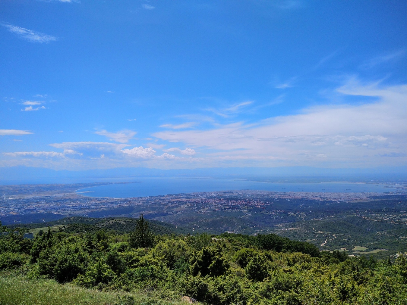
The small central square, Mana, with a plane tree, a 50s-style cafe and water fountain offers a step back in time. Right above the square lies the Church of Aghios Andreas, part of an old monastery founded in 870. The alleyways around the church, with their whitewashed and stone houses, comprise one of the most interesting sections of Peristera. The square above the church is an ideal starting point for walks. One easy forest path leads to the Chapel of Aghios Haralambos about 300 meters on. Continuing east, you’ll shortly come to a hill with a small pavilion, providing panoramic views of the plain, the mountain summit (1,201 m) and the Thermaikos Gulf. If you can, stay to see the sunset.
Seven pleasant kilometers east of Peristera is the town of Livadi, perched on a ridge at 750 meters above sea level. Some samples of Macedonian architecture have been restored, some not. An old plane tree dominates the central square.
The 11-kilometer journey from Livadi to Petrokerasa is one of the most idyllic routes in the area. Pine, beech, chestnut and oak forests alternate with small green valleys and rocky hills. Five kilometers on, an uphill dirt road on the right leads to Profitis Ilias, on the summit of Omvrianos (1,009 m). At the 6.5 km mark, the downhill road meets a right turn that leads to the Makropana spring – a shady, green recreation area.
Petrokerasa, at 600 m, is a model village. Thanks to an energetic former community leader, its inhabitants systematically tend to their flower gardens and whitewash their houses, while also parking their tractors outside the village. Cars are not allowed into the square, which forms a most pleasant picture, with benches, small cafes and tavernas. In the quaint alleyways of Petrokerasa, you will see the traditionally wide covered balconies, stone ovens and picturesque chimneys.
What to see & do
In Petrokerasa: the rich Folk History Museum, the tsipouro distillery, the beeswax press and the flour mill; a trail through the forest with 900 steps from Mavrokopana leads to the top of Mt Omvrianos; a 4×4 route from Paliomana to Omvrianos summit; picnics at the chapels of Ai Giorgis, Ai Giannis, Aghia Triada, Panagia and Aghios Athanasios. In Livadi: at Pefka, there is a recreation area with views and a spring; at 3.5 kilometers on the road to Petrokerasa, take a right which leads to Kalogeriko – a paragliding spot (2310.476000).
ATHENSPLUS • FRIDAY, APRIL 30, 2010
